City of Cape Town (City of Cape Town)
 |
The remote Prince Edward Islands are deemed to be part of the City of Cape Town, specifically of ward 115. Cllr. Ian McMahon is the current ward councilor of ward 115.
Cape Town first received local self-government in 1839, with the promulgation of a municipal ordinance by the government of the Cape Colony. When it was created, the Cape Town municipality governed only the central part of the city known as the City Bowl, and as the city expanded, new suburbs became new municipalities, until by 1902 there were 10 separate municipalities in the Cape Peninsula. During the 20th century, many of the inner suburban municipalities became unsustainable; in 1913 the first major unification took place when the municipalities of Cape Town, Green Point and Sea Point, Woodstock, Mowbray, Rondebosch, Claremont, Maitland, and Kalk Bay were unified to create the first City of Cape Town. In 1927 the municipality of Wynberg was also merged with Cape Town, with the result that all of the Southern Suburbs were incorporated into the City.
Many new municipalities were established during the 20th century. Durbanville achieved municipal status in 1901, Goodwood in 1938, Parow in 1939, Bellville and Fish Hoek in 1940, Pinelands in 1948, Kuils River in 1950, Milnerton in 1955, Kraaifontein in 1957, Gordon's Bay in 1961, Brackenfell in 1970. In 1979 Bellville was upgraded to city status. The areas not included in a municipality were governed by divisional councils. Most of the Cape metropolitan area fell under the Divisional Council of the Cape, while the eastern parts around Brackenfell, Kuils River and the Helderberg area formed part of the Divisional Council of Stellenbosch, and an area in the northeast around Kraaifontein formed part of the Divisional Council of Paarl.
In earlier years the right to vote in local elections was not restricted by race (see Cape Qualified Franchise), but the policies of the apartheid government aimed for complete segregation of local government. A 1962 amendment to the Group Areas Act introduced management committees for the areas designated for coloured and Indian residents. These management committees were subordinate to the existing local authority—either a municipality or the divisional council. From 1972 no new non-white voters could be registered as voters for municipal or divisional councils, and existing non-white voters lost their voting rights when a management committee was established for the area where they lived.
In 1982 the Black Local Authorities Act created elected town councils for black communities. Five such councils were established in the Cape metropolitan areas. They were generally regarded as under-resourced and unsustainable, and were opposed by the United Democratic Front and other civic organisations. Turnout in BLA elections was very low.
In 1987 the divisional councils of the Cape, Paarl and Stellenbosch were dissolved and the Western Cape Regional Services Council (RSC) was created in their place. The RSC councils were indirectly elected, consisting of representatives nominated by all the local authorities within its area, including municipalities, management committees and town councils. The Cape Rural Council represented the rural areas of the RSC that were not included in any local authority. Also in 1987, an act of the House of Assembly allowed the creation of local councils for white communities in peri-urban areas.
Thus at the end of apartheid in 1994, there were over 50 different local authorities in existence in the metropolitan area, listed below.
* Western Cape Regional Services Council (RSC)
* Cape Rural Council
Map - City of Cape Town (City of Cape Town)
Map
Country - South_Africa
 |
 |
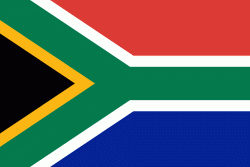
| Flag of South Africa | |
About 80% of the population are Black South Africans. The remaining population consists of Africa's largest communities of European (White South Africans), Asian (Indian South Africans and Chinese South Africans), and multiracial (Coloured South Africans) ancestry. South Africa is a multiethnic society encompassing a wide variety of cultures, languages, and religions. Its pluralistic makeup is reflected in the constitution's recognition of 11 official languages, the fourth-highest number in the world. According to the 2011 census, the two most spoken first languages are Zulu (22.7%) and Xhosa (16.0%). The two next ones are of European origin: Afrikaans (13.5%) developed from Dutch and serves as the first language of most Coloured and White South Africans; English (9.6%) reflects the legacy of British colonialism and is commonly used in public and commercial life.
Currency / Language
| ISO | Currency | Symbol | Significant figures |
|---|---|---|---|
| ZAR | South African rand | Rs | 2 |
| ISO | Language |
|---|---|
| AF | Afrikaans language |
| EN | English language |
| ST | Sotho language |
| SS | Swati language |
| TS | Tsonga language |
| TN | Tswana language |
| VE | Venda language |
| XH | Xhosa language |
| ZU | Zulu language |


